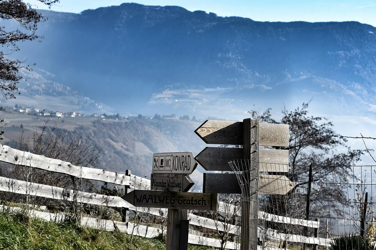
Past the last farmhouse above Gallio the tarmac runs out, the grass closes in, and the path splits three ways. There is no signal, no open app, and a wooden post with four arrows pointing in four directions. The one you want has a name half erased by weather and a number you have never seen before. This is the moment when knowing how to read a trail sign stops being a nice piece of local knowledge and becomes the difference between a fine afternoon and a long, grumpy one.
Few places in the Veneto are as well signposted as the Altopiano dei Sette Comuni. The network is dense, maintained largely by volunteers, and generous with information once you understand the grammar of it. What follows is that grammar: the paint, the numbers, the times, the grades, and the small things worth checking before you lock the car.
The Red and White Stripe: What a Blaze Is Telling You
Most official Altopiano trails are marked with paint. Typically a horizontal band of red with a white stripe inside it, or a red-white-red sandwich, applied to a beech trunk, a limestone boulder, or the corner of a barn. It is not decorative. A blaze confirms that you are still on the route, and nothing more.
That distinction matters, because people read blazes as if they were arrows. They are not. A stripe on a rock at a fork says "the path passes here" — it does not say which of the two branches to take. The way to use a blaze is to find the next one before you commit: look ahead across the meadow, along the treeline, up the line of the old mule track. On open ground the marks may be several hundred metres apart, since you can see them from a distance. In dense wood they come closer together. If five minutes pass without a stripe, the honest answer is that you have probably left the route — stop, backtrack to the last mark you clearly remember, and start again from there.
In some areas a double blaze, one mark above another, hints at a turn just ahead. Treat it as a hint rather than a rule; local painting habits differ from valley to valley and from one maintenance season to the next. Higher up, above the treeline, you will also meet cairns — small stacked stone piles. They mark the way across stony ground where paint will not hold. Do not confuse them with boundary stones or with the rough markers left by hunters and woodcutters, which can lead you somewhere very specific and not at all where you wanted to go.
Numbers, Destinations, and the Small Print on the Post
At junctions you will find a wooden or metal post with one or more plates. A good plate carries four pieces of information: the route number, the destination, the altitude in metres, and the walking time. Sometimes there is a distance in kilometres as well, and often an arrow.
The number is the most stable thing on the sign. Routes carry numbers the way streets do, and the same number will appear on maps, on other posts further along, and in guidebooks. Numbers can overlap, too — a stretch of path may be shared by two or three routes, so a plate listing three numbers is not a mistake. At a junction, look at which number sits beside which arrow rather than reading the whole plate as one instruction.
Destinations are less reliable. A plate may name the next malga, the next village, or a peak three hours away, depending on who made it and when. Altitude is your friend here: if a destination sits at 1,900 metres and you are at 1,200, the plate is telling you something useful about the shape of the day ahead.
The Time on the Sign Is One Way, and It Isn't Yours
Signposted times are almost always one-way. They are calculated for a steady adult walker on dry ground, uphill included, and they generally exclude stops. They are also, on older plates, optimistic.
The practical fix is to calibrate. Next time you walk a stretch you know well, time yourself against the sign. If the plate says forty minutes and you take fifty, you now have a conversion factor for every other sign on the plateau. Add extra for children, for a dog that wants to investigate everything, for wildflower photographs in June, for mud after rain, for the last half hour of daylight when legs get tired. A return leg is not automatically faster.
Then apply the rule that matters most: plan to be back well before dark, not exactly at it. Summer afternoons on the Altopiano can turn from bright to thunderous in under an hour, and a path that took two hours in sunshine takes longer in hail. Doubling the signposted time and adding a buffer for lunch is not cautiousness; it is arithmetic.
Difficulty Grades, Translated
Italian hiking grades follow a scale maintained by the Club Alpino Italiano, and most Altopiano signage and maps use it. Four letters cover almost everything you will meet.
- T — turistico. Easy walking on farm tracks, forest roads and gentle paths. Suitable for anyone who can walk for a couple of hours, including children and older walkers. No exposure, no scrambling.
- E — escursionistico. The standard mountain path. Uneven ground, roots, stones, some steep sections, but no technical difficulty and no need for hands. Most of the plateau's classic walks sit here.
- EE — per escursionisti esperti. For experienced walkers. Steep, exposed or faintly marked sections, scree, and places where you may need your hands for balance. Route-finding can be genuinely unclear in mist.
- EEA — escursionisti esperti con attrezzatura. Via ferrata and equipped paths, with cables, ladders or pegs. Proper gear and experience are assumed, not optional.
One thing the letter does not tell you is length. A grade describes the hardest few metres of a route, not its average. A short EE is a different proposition from a six-hour E, and a T that runs for four hours is still four hours of walking. Read the grade and the time together, then add the weather.
Junctions, Symbols and the Notices Nobody Reads
Many plates carry small pictograms: a spring, a refuge, a bivouac, a boundary cross, a viewpoint. They are worth thirty seconds of attention. A spring symbol does not guarantee water in late August, and a refuge symbol does not guarantee that the kitchen is open on a Tuesday in October. Treat both as "there is a building" and "there may be water" rather than as promises.
At the bottom of the post, or on a laminated sheet stapled to it, you will sometimes find a notice about forestry work, a temporary closure, or a hunting period. These are not bureaucratic noise. A working forest means vehicles on the track and trees coming down; a closed section means the alternative is the long way round. Photograph the notice if your Italian is shaky and ask at the bar in the village below. And on pasture land, close every gate you open, keep dogs on a lead around cattle, and give cows with calves a wide berth rather than walking between them.
Before You Set Out: A Short Checklist
- A paper map. The 1:25,000 sheets covering the plateau are detailed enough to show the route numbers you will see on the posts.
- The forecast, checked the same morning. Not the day before.
- Water and something to eat beyond what you think you need. Malghe close, springs dry up, and opening hours are seasonal.
- A charged phone with an offline map downloaded. Signal on the plateau is patchy at best in the woods.
- Someone who knows your plan. Route, car park, expected return. A message before you leave and another when you are down.
- Footwear with a real sole and a layer for wind. The plateau is high and open; the temperature up top is not the temperature in Asiago.
- A photograph of the first junction sign. Two seconds, and it settles most arguments later.
If something does go wrong, the European emergency number 112 works from any phone with a signal, and knowing the number of the route you are on and the name of the last place you passed makes the call far quicker.
When the Paint Stops
Sooner or later it happens: the blazes thin out, the path becomes a suggestion, and the sensible question arrives a little later than it should have. The answer is unglamorous. Turn around. Walk back to the last mark you are certain of, and either pick up the route from there or take the way you came. The mountain will still be there next weekend, and the malga you were heading for will still be serving polenta.
The habit worth building is smaller than any of this: at every junction, stop for ten seconds. Read the number, read the time, look for the next stripe before you move. Do that three or four times in a morning and the Altopiano stops being a place where you hope the signs are right, and becomes a place you can read.
Photo: bummelhummel / Pixabay